

Burnt Bluff Pictographs
The Garden Peninsula is famous, as the location of a Michigan ghost town, Fayette. Fayette was an iron producing community and has been carefully restored. It is now an historic State Park, visited by thousands every year. There is another great treasure on this peninsula. Nearly forgotten, are the prehistoric cliff paintings, up on Burnt Bluff. The cliff paintings, pictographs at a sacred site, are located up on the cliff side, at and around, Spider Man Cave. At one time this site was a popular tourist attraction. Unlike Fayette, the drawings at Burt Bluff had no protections at all.
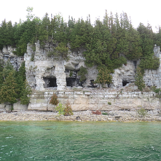
Burnt Bluff is a limestone cliff, on the shore of Big Bay de Noc, much like the cliffs visible at Fayette. The bluff is about 150 high. Spider Cave is a water-cut cave created around 4,000 years ago. It sits about 20 feet above the current level of the lake suggesting that water levels were much higher at that time.
In the 1960s the Lang family owned the land above the bluff. They built a set of stairs up to the cave and conducted a very successful tourism business for many years. It was at that time that the site was surveyed, and the caves were excavated. One cave reportedly contained burials, another contained hundreds of projectile points. At that point in time, the images were clearly visible. In the 1970s, Fayette State Park gained jurisdiction over the Burnt Bluff site. Spider Cave was listed on the National Register of Historic Places in 1971. At that point in time were at least 13 pictographs at this site. Reportedly, 4 were inside the cave, and the rest were along the cliff face. At first, there was no communication with local indigenous communities concerning the preservation of this area.
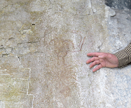
By 1995, things had changed dramatically. By then, only 4 of the images were still visible, and all of them were badly faded. The deterioration of the images was the result of several factors. Unfortunately, fame brought visitors and visitors cause damage. Images were dampened to make them more visible. People touched them and, walking about, kicked up dust, that clung to the pictures. Natural processes, like the growth of molds, also damaged the images. Even though the damage was known to the state, no measures were instituted to preserve these unique works of art. During a survey in 2016, we could only locate 3 drawings, all are in very bad condition. I would guess that, within a few years, they will be impossible to find unless you know exactly where to look.
There have been all kinds of interpretations of the meaning of these images. Some are pretty fanciful. If you consult the traditions of the Ojibway, you find these explanations. The “spider man” pictograph is a representation of Mide. The circles beneath the torso represent the circles of our lives. They indicate the many pathways we can choose during our life journey. The “big man” pictograph depicts Bug-way'ji-nini, the Sacred Protector of the Forest. He is a guardian of this sacred site. The deterioration of these images, and the desecration of this sacred site is egregious. A precious treasure has been wasted and an historic site lost.